Storm 5 Alert: Tornado Watch in effect for most of Middle Tennessee until 4 pm – NewsChannel5.com
![items.[0].videoTitle](http://www.onenashville.org/wp-content/uploads/2020/08/storm-5-alert-tornado-watch-in-effect-for-most-of-middle-tennessee-until-4-pm-newschannel5-com.jpg)
Lelan Statom’s morning forecast for Friday, August 28, 2020.

NASHVILLE, Tenn. (WTVF) — A Storm 5 Alert is in effect Friday as the remnants of Hurricane Laura could bring heavy rain, wind and quick, spin-up tornadoes to Middle Tennessee.
Watch live coverage below:

A Tornado Watch has been issued for the following counties: Cheatham, Davidson, Decatur, Dickson, Giles, Hardin, Hickman, Houston, Humphreys, Lawrence, Lewis, Marshall, Maury, McNairy, Montgomery, Perry, Robertson, Wayne and Williamson.
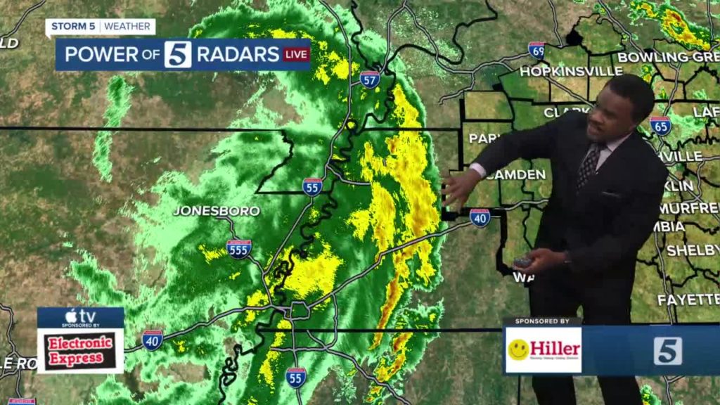
A line of storms has already prompted one Tornado Warning for several Middle Tennessee counties as it moved across the area. Those warnings expired around 12: 30 p.m.
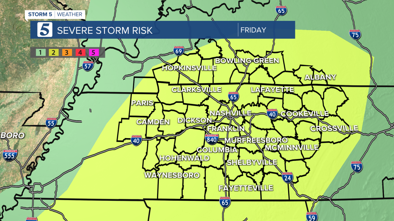
The Storm Prediction Center has upgraded our severe weather threat to a two out of five risk.
This system will bring waves of rain and storms across our area. Most of Middle Tennessee and South Central Kentucky are under a Flash Flood Watch from noon today until 3 a.m.
The flash flooding threat is greater in our northwest areas. This afternoon and tonight will be breezy, with winds at 15-25 mph and gusts at 30-40 mph outside of storms.
Most of this should be to the east by midnight – 1 a.m.; however, the system could hold on a little longer between 3 a.m. – 5 a.m. along the Plateau.
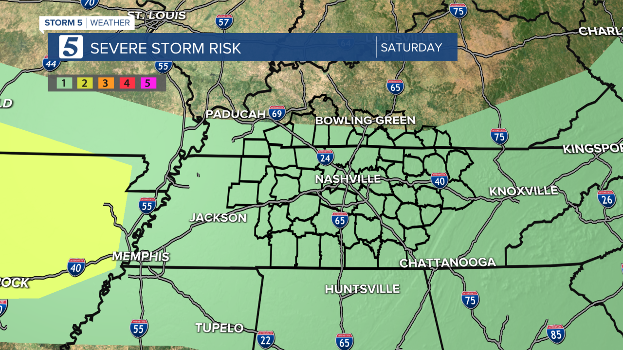
Behind it, a cold front will move through our area Saturday afternoon/evening.
Hurricane Laura made landfall overnight Thursday as a powerful category 4 storm with winds near 150 mph.
Latest update as of Friday morning:
Stay with NewsChannel 5 for the latest updates.
Copyright 2020 Scripps Media, Inc. All rights reserved. This material may not be published, broadcast, rewritten, or redistributed.